DWD ICON D2 Wettermodell

WX Deweko · ICON-D2 Karten-Center

Signifikantes Wetter, Temperatur, Niederschlag, Windböen & Bewölkung

Stand der Daten:
12.12.2025 13:23 Uhr

ICON-D2

Signifikantes Wetter

Zeigt signifikantes Wetter wie Gewitter, Starkregen, Schnee und GlĂ€tte. Ideal fĂŒr eine schnelle GefahreneinschĂ€tzung.
sigwx_icon-d2_2025121209_step004 HD Wettermodell Icon D2 +4h
GĂŒltig: 12.12.2025 14:00 Uhr
sigwx_icon-d2_2025121209_step001 HD Wettermodell Icon D2
+1h (+1h) 11:00
sigwx_icon-d2_2025121209_step002 HD Wettermodell Icon D2
+2h (+2h) 12:00
sigwx_icon-d2_2025121209_step003 HD Wettermodell Icon D2
+3h (+3h) 13:00
sigwx_icon-d2_2025121209_step005 HD Wettermodell Icon D2
+5h (+5h) 15:00
sigwx_icon-d2_2025121209_step006 HD Wettermodell Icon D2
+6h (+6h) 16:00
sigwx_icon-d2_2025121209_step007 HD Wettermodell Icon D2
+7h (+7h) 17:00
sigwx_icon-d2_2025121209_step008 HD Wettermodell Icon D2
+8h (+8h) 18:00
sigwx_icon-d2_2025121209_step009 HD Wettermodell Icon D2
+9h (+9h) 19:00
sigwx_icon-d2_2025121209_step010 HD Wettermodell Icon D2
+10h (+10h) 20:00
sigwx_icon-d2_2025121209_step011 HD Wettermodell Icon D2
+11h (+11h) 21:00
sigwx_icon-d2_2025121209_step012 HD Wettermodell Icon D2
+12h (+12h) 22:00
sigwx_icon-d2_2025121209_step013 HD Wettermodell Icon D2
+13h (+13h) 23:00
sigwx_icon-d2_2025121209_step014 HD Wettermodell Icon D2
+14h (+14h) 00:00
sigwx_icon-d2_2025121209_step015 HD Wettermodell Icon D2
+15h (+15h) 01:00
sigwx_icon-d2_2025121209_step016 HD Wettermodell Icon D2
+16h (+16h) 02:00
sigwx_icon-d2_2025121209_step017 HD Wettermodell Icon D2
+17h (+17h) 03:00
sigwx_icon-d2_2025121209_step018 HD Wettermodell Icon D2
+18h (+18h) 04:00
sigwx_icon-d2_2025121209_step019 HD Wettermodell Icon D2
+19h (+19h) 05:00
sigwx_icon-d2_2025121209_step020 HD Wettermodell Icon D2
+20h (+20h) 06:00
sigwx_icon-d2_2025121209_step021 HD Wettermodell Icon D2
+21h (+21h) 07:00
sigwx_icon-d2_2025121209_step022 HD Wettermodell Icon D2
+22h (+22h) 08:00
sigwx_icon-d2_2025121209_step023 HD Wettermodell Icon D2
+23h (+23h) 09:00
sigwx_icon-d2_2025121209_step024 HD Wettermodell Icon D2
+24h (+24h) 10:00
sigwx_icon-d2_2025121209_step025 HD Wettermodell Icon D2
+25h (+25h) 11:00
sigwx_icon-d2_2025121209_step026 HD Wettermodell Icon D2
+26h (+26h) 12:00
sigwx_icon-d2_2025121209_step027 HD Wettermodell Icon D2
+27h (+27h) 13:00
sigwx_icon-d2_2025121209_step028 HD Wettermodell Icon D2
+28h (+28h) 14:00
sigwx_icon-d2_2025121209_step029 HD Wettermodell Icon D2
+29h (+29h) 15:00
sigwx_icon-d2_2025121209_step030 HD Wettermodell Icon D2
+30h (+30h) 16:00
sigwx_icon-d2_2025121209_step031 HD Wettermodell Icon D2
+31h (+31h) 17:00
sigwx_icon-d2_2025121209_step032 HD Wettermodell Icon D2
+32h (+32h) 18:00
sigwx_icon-d2_2025121209_step033 HD Wettermodell Icon D2
+33h (+33h) 19:00
sigwx_icon-d2_2025121209_step034 HD Wettermodell Icon D2
+34h (+34h) 20:00
sigwx_icon-d2_2025121209_step035 HD Wettermodell Icon D2
+35h (+35h) 21:00
sigwx_icon-d2_2025121209_step036 HD Wettermodell Icon D2
+36h (+36h) 22:00
sigwx_icon-d2_2025121209_step037 HD Wettermodell Icon D2
+37h (+37h) 23:00
sigwx_icon-d2_2025121209_step038 HD Wettermodell Icon D2
+38h (+38h) 00:00
sigwx_icon-d2_2025121209_step039 HD Wettermodell Icon D2
+39h (+39h) 01:00
sigwx_icon-d2_2025121209_step040 HD Wettermodell Icon D2
+40h (+40h) 02:00
sigwx_icon-d2_2025121209_step041 HD Wettermodell Icon D2
+41h (+41h) 03:00
sigwx_icon-d2_2025121209_step042 HD Wettermodell Icon D2
+42h (+42h) 04:00
sigwx_icon-d2_2025121209_step043 HD Wettermodell Icon D2
+43h (+43h) 05:00
sigwx_icon-d2_2025121209_step044 HD Wettermodell Icon D2
+44h (+44h) 06:00
sigwx_icon-d2_2025121209_step045 HD Wettermodell Icon D2
+45h (+45h) 07:00
sigwx_icon-d2_2025121209_step046 HD Wettermodell Icon D2
+46h (+46h) 08:00
sigwx_icon-d2_2025121209_step047 HD Wettermodell Icon D2
+47h (+47h) 09:00
sigwx_icon-d2_2025121209_step048 HD Wettermodell Icon D2
+48h (+48h) 10:00

Modell Video Download

💡
Animations-Center:
Hier finden Sie die Animationen des aktuellen Modelllaufs.
ICON-D2

Modelllauf: 12.12.2025, 10:00 Uhr

Aktuell
sigwx_icon-d2_2025121209_48h HD Wettermodell Icon D2
Signifikantes Wetter
rain_icon-d2_2025121209_48h HD Wettermodell Icon D2
Niederschlag (Gesamt)
temp_icon-d2_2025121209_48h HD Wettermodell Icon D2
Temperatur (2m)
wind_icon-d2_2025121209_48h HD Wettermodell Icon D2
Windböen (Max)
clouds_icon-d2_2025121209_48h HD Wettermodell Icon D2
Bewölkung (Gesamt)

Block-Titel

Was ist das ICON-D2?

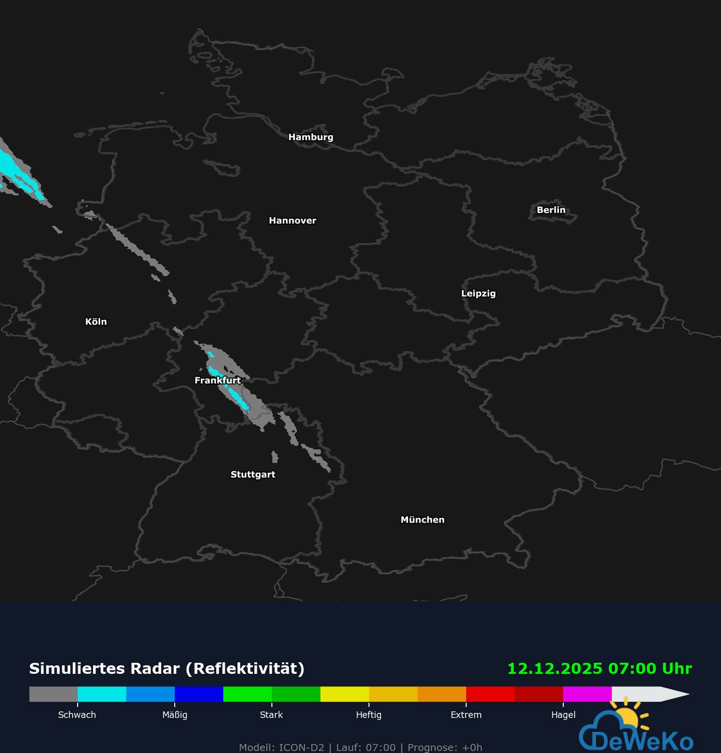
Das ICON-D2 ist das Flaggschiff des DWD fĂŒr die KĂŒrzestfristvorhersage. Es ist speziell darauf ausgelegt, das Wetter in Deutschland und den direkten NachbarlĂ€ndern so detailliert wie möglich vorherzusagen. Es ist der Nachfolger des Ă€lteren COSMO-D2 Modells.Das „ICON“ steht fĂŒr die spezielle Gitterstruktur (Ikosaeder, also Dreiecke statt Vierecke), und das „D2“ steht fĂŒr Deutschland und die feine Auflösung von ca. 2 km.Auflösung (rĂ€umlich): ca. 2,2 km.Das ist extrem fein. Zum Vergleich: Das globale europĂ€ische Modell (ECMWF) hat eine Auflösung von ca. 9 km, das globale amerikanische GFS eher 13–22 km.Durch diese Feinheit kann das Modell einzelne TĂ€ler, Gebirge und sogar grĂ¶ĂŸere Gewitterzellen direkt „sehen“.

  • Vorhersagegebiet: Deutschland, Alpenraum und angrenzende NachbarlĂ€nder.Aktualisierung: Alle 3 Stunden (neuer Lauf um 00, 03, 06 Uhr usw.) Vorhersagezeitraum: Es schaut bis zu 48 Stunden in die Zukunft (perfekt fĂŒr den aktuellen und nĂ€chsten Tag).

  • Was kann das Modell besonders gut?

    1. Gewitter und Starkregen: Da es „nicht-hydrostatisch“ rechnet (es erlaubt vertikale Bewegungen der Luft), kann es Gewitterwolken selbststĂ€ndig simulieren, statt sie nur grob abzuschĂ€tzen. Es ist daher das wichtigste Werkzeug fĂŒr Unwetterwarnungen bei Sommergewittern.

    2. Radar-Daten nutzen: Es ist eines der wenigen Modelle, das aktuelle Daten aus den Regenradaren direkt in die Berechnung einspeist. Wenn es also gerade irgendwo anfĂ€ngt zu regnen, weiß das Modell das im nĂ€chsten Lauf sofort und passt die Vorhersage an.

    3. Orografie (GelĂ€nde): Dank der hohen Auflösung werden lokale Windsysteme (z. B. Föhn in den Alpen, Böhmischer Wind, KĂŒstenkonvergenzen) sehr gut erfasst.

SchaltflĂ€che "ZurĂŒck zum Anfang"